01254 943 270
enquiries@darwenauctioneers.co.uk
G85 Weekly General Auction Monday
Lot 379:
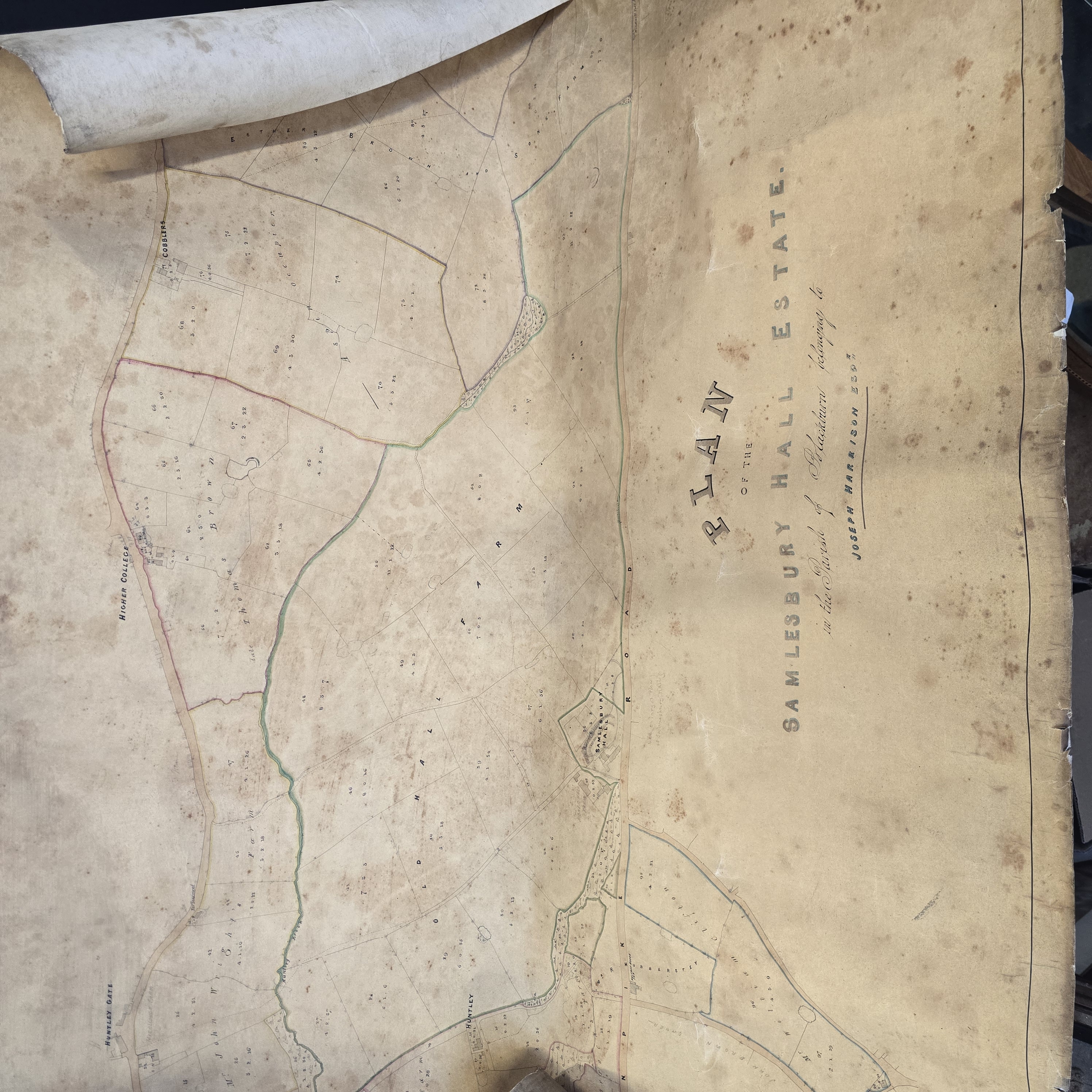
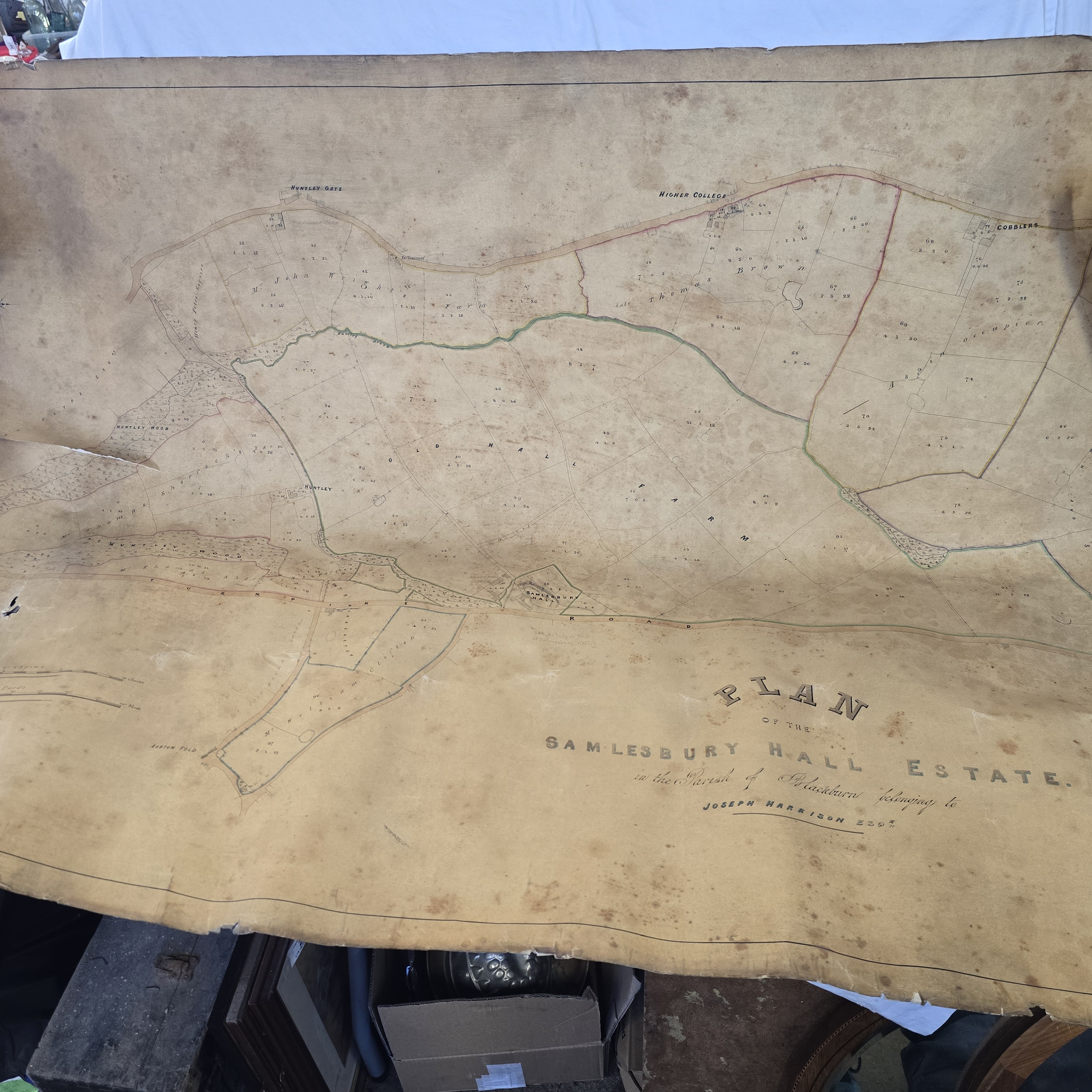
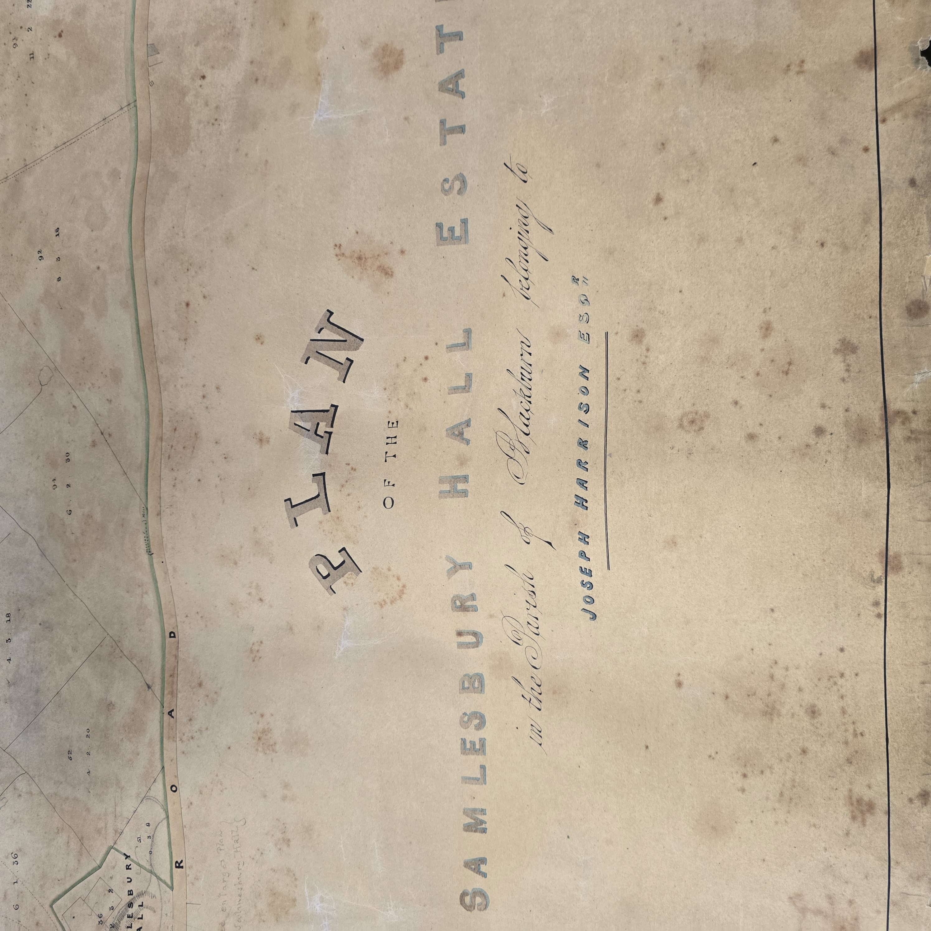
A Mid-19th Century Hand-Coloured Estate Plan of the Samlesbury Hall Estate
Description
A large-scale cadastral estate map of the Samlesbury Hall Estate, situated in the Parish of Blackburn, Lancashire. The plan is titled Plan of the Samlesbury Hall Estate in the Parish of Blackburn belonging to Joseph Harrison Esqr. Joseph Harrison purchased the hall in 1862, providing a mid-to-late 19th-century date for the document. The map is executed on paper, appearing to be linen-backed, and features hand-coloured outlining in red, green, and blue to delineate various boundaries and topographical features. The plan provides a detailed layout of the grounds, including individual field boundaries, roadways, and watercourses. Specific landmarks and buildings are identified by name, including Samlesbury Hall, Higher College, Huntley Gate, Cobblers, and Old Hall Farm. Various land parcels are numbered and include the names of occupiers or previous owners, such as Mr John Wright and Late Thomas Brown. The document is currently stored in a rolled state.